

4 minutes read
Explore the History of California’s largest State Park, from its geologic formation 7 million years ago to wildlife evolution and human footprints. Let’s time travel!
A Pinch of History
- Established in 1933, Anza-Borrego desert is the largest State Park in California (approximately 620,000 acres of land)
- It’s named after Spaniard explorer Juan Bautista de Anza and peninsular bighorn sheep (Borrego in Spanish)
- More than 600 species of flowers have been identified in the park.
- During World War II, it was a training terrain for the U.S. Army.
Desert Formation
Today topography has been formed by millions of years of erosion and active faults. As you drive through and/or hike the park, you will discover eroded badlands and unique geologic features.
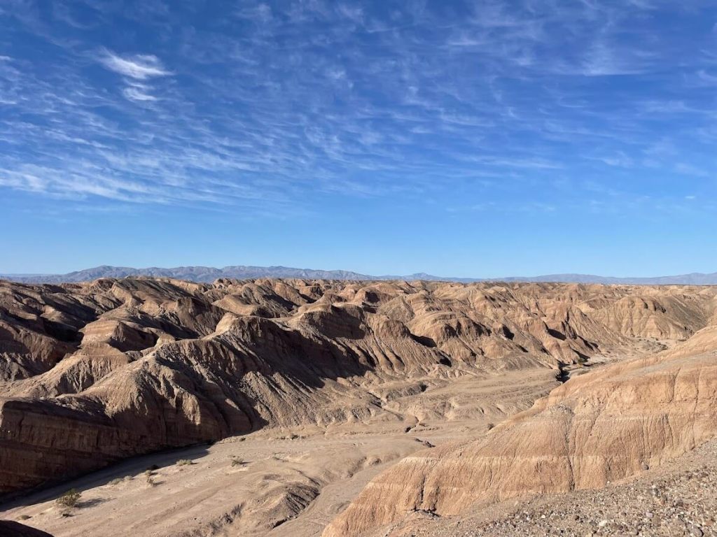
Fossils and sediments found suggest a warm climate around 7 million years ago (like Central and South America today). In addition, fossils like clams, shrimps, sharks, or bony fish indicate an active marine life.

Climate changed to a drier environment around the late Miocene period (5 million years ago). Besides, the mountains between San Diego and the Anza-Borrego Desert prevent rain from crossing, causing aridity in this area.

Land of Wildlife
Wildlife has been abundant in the region. More than 100 vertebrate and invertebrate fossils have been recorded. Most of them are mammals, birds, and reptiles from the Pleistocene Period (3 million years ago).

With an estimated wingspan of 17 feet (5 meters), Teratornis incredibilis, the condor-like vulture was the largest bird fossil discovered (Pleistocene Epoch).
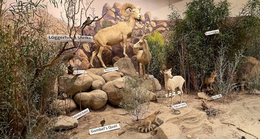
Desert animals had adapted to this now arid and waterless environment. As an example, they are more active at night or twilight to conserve water. Some, like the kangaroo rat, can generate moisture from dry food.
Did you know?
Since 1873, bighorn is a protected species in California.
Today, wildlife is protected in the park. You may encounter bighorn sheep, coyotes, rattlesnakes, bobcats, rabbits, mountain lions, and more.

Land of Human
Human remains and evidence of settlement of four different periods have been founded in the region:
- The San Dieguito (Early Holocene period)
- The Pinto Basin (Middle Holocene period)
- The prehistoric Yuman (around A.D. 500)
- The prehistoric Shoshonean
- And the contemporary Native American groups: the Kumeyaay, and Cahuilla
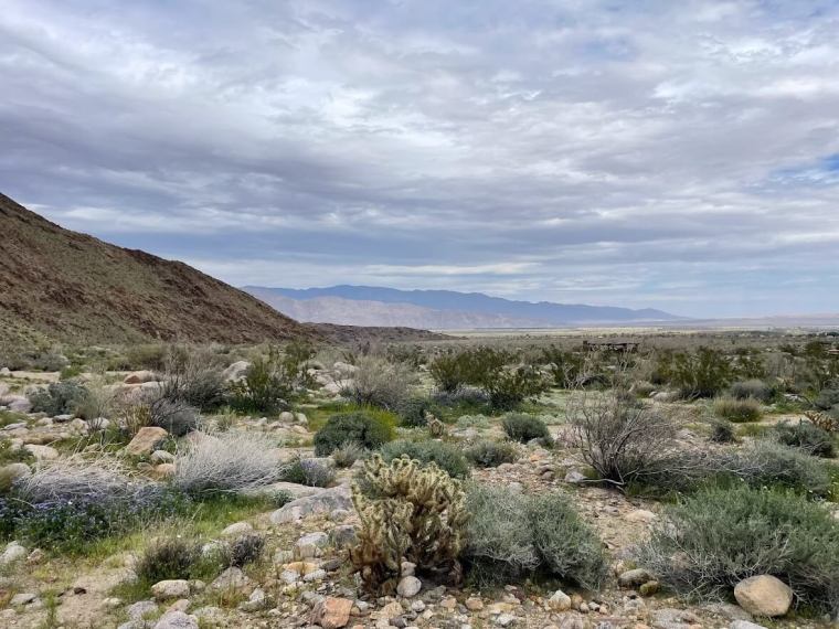
The Kumeyaay were located Central and South of the park, and Cahuilla were in the North. They were semisedentary, living in the desert from winter to spring. Even if they spoke different languages and had different cultures, both tribes developed wide travel networks and trade relationships.

Did you know?
Agave, acorn, pine nut, and honey mesquite pods were the most important source of food for desert Native American.

Histories of these hunter-gatherers were passed down generations through songs and stories (there was no written language). Archeologists have been learning their daily lives and culture thanks to many artifacts found in the park.
Did you know?
“For both tribes, Bird songs tell the story of creation and of the People’s relationship to all living things. *”
‘* Source: Anza-Borrego Desert State Park Visitor Center

By bringing new diseases, and establishing property concepts, Spaniards contributed to the decline of the desert Native American population. From 5,000-6,000 Cahuilla Indians in 1850 to 800 in 1910. And from 3,000 Kumeyaay Indians in 1770 to 322 in 1930.
Explorers Footprints
Around 1702, the Spaniards’ reports confirmed that California was a peninsula. After missions and presidios settlements in Alta California, Spaniards looked for a land route from New Spain (now Mexico) to strengthen their positions. An opening in the mountains to the western and northern regions was then a better possibility. Indeed, sea trips were limited and uncertain.

Did you know?
Early explorers believed that California was an island
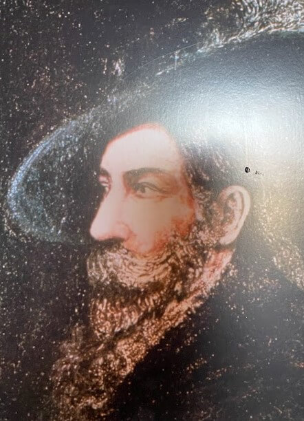
As his father, Juan Bautista de Anza believed in the existence of the road via the Sonoran Desert connecting the Colorado River to California missions.
He led two expeditions in two years.
He mapped the road during the first one, escorted by less than 30 people and 200 livestock.

The second one started from San Miguel de Horcasitas (Mexico) on September 29, 1775, stopped in San Gabriel on January 4th, 1776, and ended on June 27, 1776, in San Francisco. It was a more than 1,000 miles route, and Anza successfully supplied 240 settlers and lass than 800 animals (horses, mules, and cattle) to establish El río de San Francisco.
Did you know?
Native American Sebastián Tarabal guided Anza to navigate through the desert.
During the next five years, it is possible that between 35% to 50% of Californian settlers arrived by the Anza road.


In July 1781, Yuman Native Americans destroyed missions assuring the Colorado crossing near Yuma. Anza-route was closed after these destructions. The Fages trail, discovered in 1772 by Lieutenant Pedro Fages while chasing deserters, was an alternative route. However, this passage from San Diego to the Colorado desert and the San Joaquin Valley was not safe due to hostile Yuma Native Americans.

Closed for more than 40 years, now-independent Mexico re-opened the Sonora to California road in 1825. Later on, additional routes carried immigrants and adventurers through the park. The Southern Immigrant Trail, a road between the eastern United States and California, was the most famous.

Since the 1880s, prospectors and cattlemen had settled in the Anza-Borrego desert to prosper. It was not economically fructuous, and the desert population declined.

During the 1930s, a group of people worked to protect it, and Anza-Borrego State Park was created in 1933.

Article based on my visit in March 2023
Ready to explore Anza-Borrego Desert?
Tips:
- Location: Anza-Borrego Desert State Park, Borrego Springs, California
- Visitor Center: 9 am – 5 pm from October 1st to May 31st. Then open on weekends only.
- Hours: 24/7
- Admission: $10
- State Park Map: https://www.parks.ca.gov/pages/638/files/abdsp_Park_Map201704.pdf
- More information at https://www.parks.ca.gov/?page_id=638
If you enjoyed this post, please leave a comment and share it with a nature lover.
Sources:
- Our Historic Desert, The Story of the Anza-Borrego Desert by Diana Elaine Lindsay,1973.
- California Department of Parks and Recreation website.


One thought on “The History of Anza-Borrego Desert”